
Reviewed · PUERTO RICO
Puerto Rico Unlocked 500+ Hidden Gems and Spots
Puerto Rico rewards curiosity. This self-guided Google Map puts more than 500 handpicked places at your fingertips, from quiet beaches and river pools to churches, plazas, food stops, and oddball roadside sights. I like the direct Google Maps links and the freedom to build your own route instead of following a bus or fixed timetable. I also like the lifetime access and regular additions, which make the $29.99 group price especially appealing for a road trip.
The main consideration is simple: this is a planning tool, not a guided tour. You need a rental car, your own judgment, and enough time to check weather, parking, entrance fees, road conditions, and the details of each place before setting out. Some river and cave stops may also require equipment that is not supplied.
In This Review
- Five things to know before you buy
- A digital road book instead of a scheduled tour
- How the phone map works on the road
- Day 1: Rio Grande rivers and natural pools
- Day 2: Aguadilla beaches from quiet shores to food stops
- Day 3: Lares viewpoints above the coast and mountains
- Day 4: Aguada forts, churches, and colonial places
- Day 5: Luquillo food stops and Puerto Rican flavor
- Day 6: Ponce’s unusual places and one-off discoveries
- Day 7: Toa Alta plazas and everyday community life
- Day 8: Carolina churches and sacred architecture
- What the $29.99 price really buys you
- Who will get the most from this map
- Booking, access, and cancellation details
- Should you buy Puerto Rico Unlocked?
- FAQ
- What is included with Puerto Rico Unlocked?
- How much does the experience cost?
- Is this a guided tour?
- Do I need a rental car?
- Can I use the map on my phone?
- How long is the suggested experience?
- Are entrance fees included?
- Are meals and drinks included?
- Is equipment provided for river or cave visits?
- What should I know before visiting rivers?
Five things to know before you buy
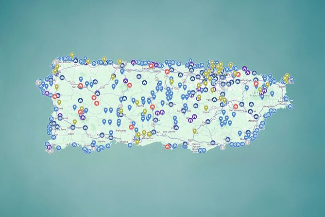
- 500-plus locations across Puerto Rico: Beaches, rivers, waterfalls, caves, food, churches, plazas, viewpoints, forts, and unusual places are grouped by interest.
- One-tap navigation: Select a pin on your phone and open its location in Google Maps.
- Eight suggested days: Each day centers on a broad area and a type of experience, but you can mix and match freely.
- $29.99 per group: One purchase covers up to 15 people, making the cost low for families and groups.
- Weather matters near rivers: Avoid river visits on cloudy days or when rain is possible, since water levels and currents can change quickly.
- No transport or guide included: You arrange the car, fuel, tolls, parking, meals, and any admission or rental equipment.
A digital road book instead of a scheduled tour
The best way to understand this product is as a large, phone-based road book. It does not gather you at a hotel, put you in a van, or explain a site in person. Instead, it gives you a pool of choices, short notes, photographs, links, and map pins so you can decide what fits your day.
That difference matters. A regular sightseeing tour is efficient, but it also controls your pace. Here, you might spend a lazy morning at a river, stop at a plaza for a short walk, or skip a beach because the weather has turned. You are in charge, for better and for worse.
The map is meant for a group of up to 15 people, and the listed price is per group rather than per person. A family of four pays the same $29.99 as a couple, which makes the value easy to see. If the map helps you avoid even a few hours of scattered online research, it may pay for itself before you leave San Juan.
The tradeoff is that quantity can create its own problem. Five hundred choices are exciting, but you cannot sensibly visit them all in one trip. I would treat the map as a menu, not a checklist. Pick a few places near one another, leave room for meals and delays, and resist the urge to chase every pin.
Other Puerto Rico trips people pair with this one:
- San Juan Guided Snorkel With Turtles Tour and Videos
★ 5.0 · 12,947 reviews - Top Rated El Yunque Rainforest & Waterslide – SmallGroup Tour
★ 5.0 · 12,789 reviews - Half-Day Yunque Rainforest Waterslide & rope swing Guided Tour
★ 5.0 · 6,534 reviews
How the phone map works on the road
The basic process is straightforward. Open the mobile map, browse the categories, tap a location, read the available notes or links, and send the place to Google Maps for directions. This is useful when you are sitting with a coffee deciding what to do next, or when a planned stop does not suit the weather.
The direct navigation links are the map’s strongest practical feature. You do not need to copy addresses from a blog, search through social media posts, or wonder which similarly named place is correct. One of the strongest benefits is time saved during trip planning.
Still, do a little preparation. A phone is not a perfect substitute for local judgment. Make sure you have a way to charge it, review the route before driving, and confirm opening details where relevant. The map includes information and links, but it does not promise that every road, business, fee, or condition will remain unchanged.
The meeting point is listed as Plaza Colón in Old San Juan, with the address code FV8Q+C57, but that does not mean a guide meets you there. It is presented as the start and end point for the activity, while the actual use of the map is self-directed. That wording can be confusing, so I would not expect transportation or an in-person welcome.
Day 1: Rio Grande rivers and natural pools
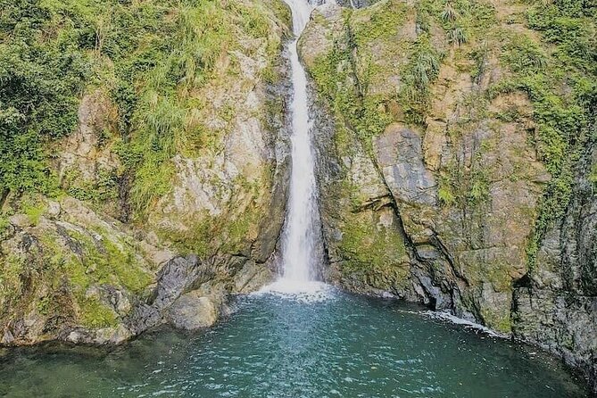
The first suggested day focuses on 87 rivers around Rio Grande. The appeal is easy to understand: waterfalls, clear pools, and jungle settings offer a cooler, more active side of Puerto Rico than a standard beach day.
This section could be useful for people who want to compare several river options rather than commit to one well-known swimming area. You can choose a stop that fits your route, energy, and weather. The photographs and notes should help you decide which places deserve serious planning.
Safety deserves more attention here than at any other part of the map. Do not visit rivers when rain is forecast, and avoid cloudy conditions according to the supplied guidance. Water can rise quickly, and strong currents may develop even when the river looks calm at your starting point.
You also need to bring or arrange any equipment required for a particular site. Helmets, life jackets, and other rentals are not included. A moderate level of fitness is recommended, but the map does not provide a single difficulty rating for all 87 locations, so read each entry carefully and make conservative choices.
Day 2: Aguadilla beaches from quiet shores to food stops
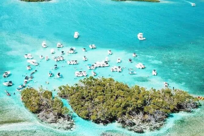
Aguadilla provides a list of 105 beaches, making this one of the most useful sections for a coast-focused trip. The collection includes quiet shores, family-friendly places, palms, and roadside food stalls, so you can shape the day around swimming, scenery, or lunch.
The advantage is variety. You are not forced to spend every beach day at the same famous strip. A group with different priorities can use the map to compare places and choose a stop that feels right for the moment.
The disadvantage is that beach conditions and facilities can vary. The material does not promise lifeguards, restrooms, changing areas, or calm water at every location. Use the photos and links as a starting point, then check the current conditions before you commit to a long drive.
Aguadilla is also a good reminder that this map works best when you think geographically. Do not try to visit a dozen beaches scattered across the island in one afternoon. Pick several in the same area, allow time for food, and keep a backup plan in case the weather changes.
A completely different sort of day out from Puerto Rico:
- El Yunque Rainforest Waterslides and Luquillo Beach w/ Transport
★ 4.5 · 5,098 reviews - Night Kayak – Condado City Lights Tour
★ 4.5 · 4,807 reviews - Luquillo Beach Horse Ride from Carabalí Rainforest Adventure Park
★ 5.0 · 4,762 reviews - Authentic Flavors of San Juan Food Tour
★ 5.0 · 4,741 reviews
Day 3: Lares viewpoints above the coast and mountains
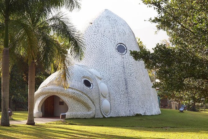
The Lares section features 21 scenic viewpoints. These stops shift the focus from swimming to long views, with mountain heights and Caribbean sea outlooks among the promised sights.
I like this category because viewpoints are easy to add to a driving day. You may not need a full afternoon at every stop, and a quick look can break up a longer journey. They are also useful for people who prefer scenery and photographs to strenuous outdoor activities.
The map does not state that every viewpoint has formal facilities or easy access. Some may be simple roadside points, and the moderate-fitness recommendation suggests that you should read the access information rather than assume every pin is effortless. Give yourself daylight and avoid rushing unfamiliar mountain roads.
Lares can work well as a slower day. Choose a handful of viewpoints, stop in a town or plaza along the way, and let the route unfold rather than measuring success by the number of pins you collect.
Day 4: Aguada forts, churches, and colonial places
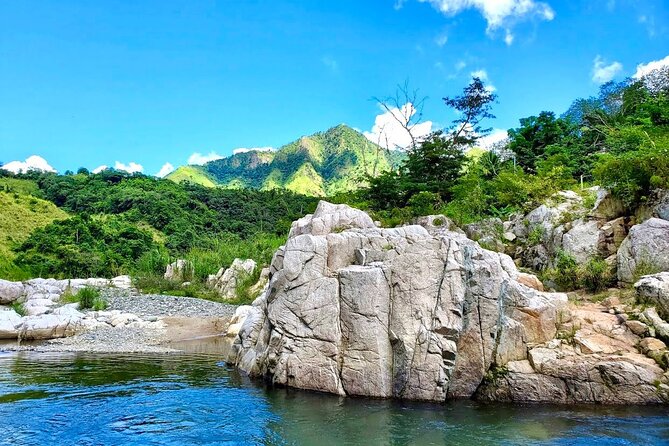
Aguada’s history-focused selection includes forts, churches, tunnels, and colonial buildings. This is the part of the map that helps you connect Puerto Rico’s scenery with its past, faith, battles, and local communities.
You do not need to be a specialist in architecture or religion to appreciate this category. A church or old building can give a driving day more meaning than a series of scenic stops. The map’s photos, notes, and links are particularly valuable here because they provide context before you arrive.
Check access carefully. A historic site may have limited hours, restricted areas, or an admission charge, and the general price does not cover those costs. The map is available around the clock, but the places themselves may not be.
This section also rewards a respectful approach. Churches are active places of worship, not simply photo backdrops. Follow posted rules, dress appropriately when needed, and remember that a quiet visit is often more rewarding than a rushed stop.
Day 5: Luquillo food stops and Puerto Rican flavor
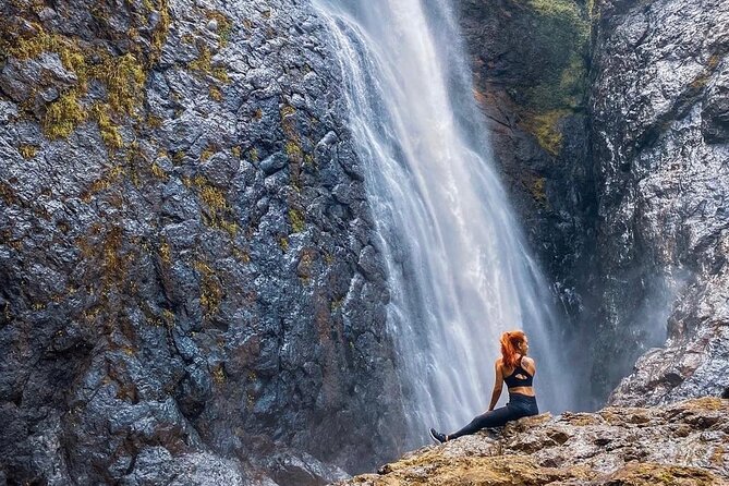
The Luquillo day centers on nine food stops. The selection points you toward alcapurrias, mofongo, lechón, tropical juices, and other Puerto Rican favorites.
This is a smart inclusion. A road trip built only around waterfalls and viewpoints can leave you tired and hungry, while food gives you a direct connection to everyday island life. I would use this list to anchor the day, then add nearby beaches or other pins around meal times.
Nine stops does not mean you should eat a full meal at each one. Think of the list as a way to compare possibilities. Share smaller portions if your group wants to sample more than one specialty, and keep personal spending in mind because meals and drinks are not included.
The food category may also be one of the map’s most immediately useful features. Restaurants and roadside stands can be hard to sort through when you are unfamiliar with an area. Having a focused list reduces the guesswork, though you should still check current hours before driving over.
Day 6: Ponce’s unusual places and one-off discoveries
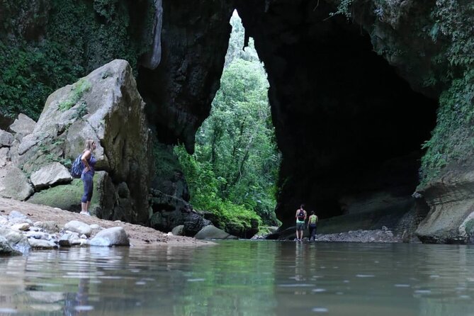
The Ponce section gathers more than 50 locations that do not fit neatly into the other categories. Examples include tunnels, unusual rock formations, waterfalls, giant sculptures, and stairways with striking views.
This may be the most playful part of the map. It encourages you to look beyond the standard beach-and-old-town plan and seek out places that make a trip feel personal. Some stops may be ideal for photographs, while others could become the unexpected highlight of a day.
Because these sites are so varied, expectations should remain flexible. The supplied information does not give a single description of access, cost, or difficulty for every place. Read the individual entry, follow its links, and do not assume an unusual location is maintained like a formal attraction.
Ponce is also far from some other parts of the island, so route planning matters. Use the map to build a sensible regional day instead of crossing Puerto Rico repeatedly for one isolated pin.
Day 7: Toa Alta plazas and everyday community life
The Toa Alta category covers more than 50 town squares. These plazas are described as places where music, children, pigeons, trees, and conversation bring local life into the open.
This is exactly the sort of stop that can get skipped when a trip is planned only around major attractions. A plaza may not require a ticket or a long visit, yet it can show you how a town works. Sit for a while, look at the surrounding buildings, and use the map’s notes to understand what makes each square worth a stop.
The category is particularly good for a group with mixed interests. Some people can rest, others can take photographs, and everyone can enjoy a short break from the car. Since the sites are public gathering places, keep your visit considerate and avoid treating ordinary community life as a staged show.
Day 8: Carolina churches and sacred architecture
The final suggested day includes more than 87 sacred sites, ranging from large cathedrals to small hilltop chapels. The focus is on faith, architecture, and the many ways religious buildings shape Puerto Rican towns.
This list gives the map more depth than a simple outdoor recreation guide. You can appreciate design, local stories, and quiet spaces even if you are not religious. It also offers a useful change of pace after several days of roads, beaches, rivers, and viewpoints.
As with the historic buildings in Aguada, check access and behave respectfully. Some sites may be open for visitors, while others may be active churches with services or limited entry. Admission is not generally included, and the map does not promise identical hours for all 87-plus locations.
Carolina is close to San Juan, so this category may be convenient near the beginning or end of a trip. You do not have to reserve it for the eighth day. The eight-day outline is a suggestion, not a schedule.
What the $29.99 price really buys you
At $29.99 per group of up to 15, the math is favorable for families and friends. A group of six pays only a few dollars per person, and everyone can use the same collection while planning different parts of the trip.
The value is not in admission to attractions. Most locations are free, but some parks, parking areas, and sites may charge. You are paying for selection, organization, photographs, tips, links, and the convenience of sending locations straight to navigation.
The lifetime access is important. You can use it for an eight-day holiday, a shorter weekend, or a future return to Puerto Rico. Regular additions also give the product more lasting value than a printed list that becomes outdated.
Your real budget will be higher once you add the rental car, fuel, tolls, parking, food, possible admission, and equipment. This is a low-cost planning aid, not an all-inclusive island pass.
Who will get the most from this map
I would recommend it most strongly to people who plan to rent a car and want freedom. It suits a couple building a flexible route, a family looking for several backup activities, or a group splitting the research instead of assigning one person to do all the work.
It is also a good fit for repeat visitors. If you have already seen the most familiar San Juan sights, the large selection gives you fresh directions to explore. The focus on plazas, churches, food, and unusual sites also suits anyone who wants more than postcard scenery.
You may not need it if you want a guided nature outing, hotel pickup, or expert commentary. It also may not suit someone who dislikes driving, relies on a fixed schedule, or wants every detail arranged in advance.
The physical demands vary, but a moderate fitness level is advised. River and cave outings may require extra care and equipment, so do not assume every pin is suitable for children or for anyone with mobility limits.
Booking, access, and cancellation details
Confirmation is received at booking, and the digital map is mobile-friendly. Access is listed from September 27, 2024 through December 28, 2026, every day from midnight to 11:30 p.m.
The experience is non-refundable and cannot be changed after purchase. Since conditions and personal plans can shift, buy only when you are confident you will use it.
The stated maximum is 30 people, while the map price covers up to 15 in a group. Since this is self-guided and no transportation is included, confirm the group arrangement if your party is larger than 15.
Should you buy Puerto Rico Unlocked?
Buy it if you want a flexible Puerto Rico road trip and value saved planning time. The strongest reasons are the enormous range of categories, direct navigation pins, low group price, and lifetime access.
Skip it if you expect a guide, transportation, guaranteed access, or a carefully timed daily tour. You will need to do the final work: choose realistic routes, check weather, confirm hours, and make safe decisions near rivers and caves.
For most independent visitors with a rental car, I think $29.99 is a sensible purchase. Use it as a well-organized source of ideas, not as a race to visit 500 places, and it can turn a familiar Puerto Rico plan into a much more personal one.
FAQ
What is included with Puerto Rico Unlocked?
You receive instant and lifetime access to a mobile Google Map with more than 500 locations across Puerto Rico. It includes clickable pins, photos, tips, links, and regular additions.
How much does the experience cost?
The price is $29.99 per group for up to 15 people.
Is this a guided tour?
No. It is a self-guided digital map. A guide, transportation, and a fixed schedule are not included.
Do I need a rental car?
Transportation is not included, and the product is designed for road trips. You are responsible for arranging transportation.
Can I use the map on my phone?
Yes. The map is designed for mobile access, and its pins can open directly in Google Maps for navigation.
How long is the suggested experience?
The suggested plan covers approximately eight days, with one broad area or theme for each day. You can use the map for a shorter or longer trip.
Are entrance fees included?
No. Most places are free, but some sites or parking areas may charge an admission or parking fee.
Are meals and drinks included?
No. Meals, drinks, fuel, tolls, parking, and personal expenses are separate.
Is equipment provided for river or cave visits?
No. Equipment such as helmets and life jackets is not provided.
What should I know before visiting rivers?
Check the weather carefully and avoid river visits on cloudy days or when rain is forecast. Water levels can rise quickly, and currents can become dangerous after rain.
Just added around Puerto Rico
- Full Charter All Inclusive for Icacos and Palomino★ 5.0 · 3 reviews
- Taxi Cab From Humacao To San Juan Airport★ 4.5 · 3 reviews
- Professional Photoshoot in the Vibrant Streets of Old San Juan★ 5.0 · 3 reviews
- Premium Transfer Service FROM or TO Rio Grande Puerto Rico★ 5.0 · 3 reviews
- Private El Yunque Tour To Hidden Waterfall Remote Area★ 3.5 · 3 reviews
- ToroRoller★ 4.5 · 3 reviews
- Largest Natural Waterslide, River Hike and Beach Tour in Arecibo★ 5.0 · 3 reviews
- All-Inclusive Full-Day Private Boat Tour with Lunch & Drinks★ 5.0 · 3 reviews